Store Home
Product Details
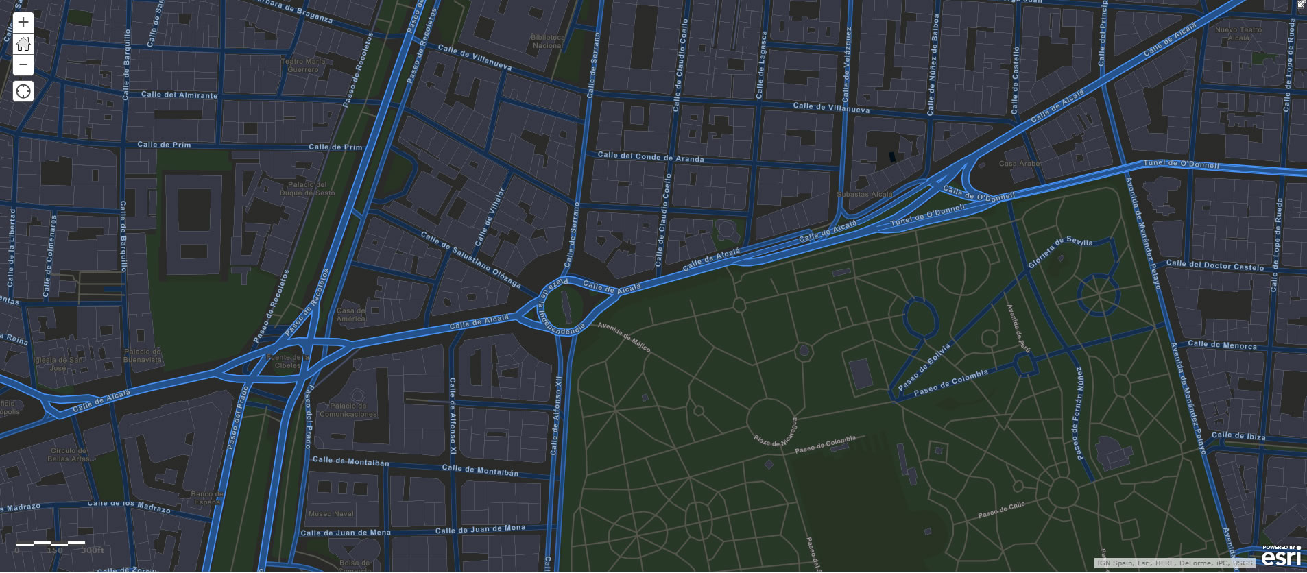
Navigation & Maps
ESRI ArcGIS for Desktop 10.4
Availability:
In stock
Operating Systems:
Windows
Languages:
English
Terms of Use:
Overview
Professional GIS Authoring
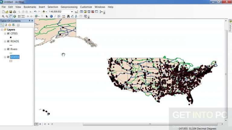
There are lots of ways to make a map. But if people use your maps to make decisions that save money, time, or even lives, then you need to put science to work for you. Use ArcGIS for Desktop to build maps with up-to-date data, combined with deep analysis, and share them where they’ll have the most impact.
Create Smart Maps and Useful Apps
Visualize and share information in new ways for insightful and informed decision making. Map and manage your data with ArcGIS for Desktop, then create apps and share with others via the rest of the ArcGIS platform. ArcGIS for Desktop includes ArcGIS Online, so you immediately have access to a world of relevant content and ready-to-use apps to get you started right away.
Transform Your Data into Actionable Information
Create, edit, analyze and share information in powerful and efficient ways. Turn 2D data into 3D for powerful visualization. Easily import and edit data to get at the information you need. Perform analysis to solve your problems. The value-added information you create with ArcGIS for Desktop will transform how decisions are made and results are realized.
Be a Trusted Source of Relevant Information
Build mapping solutions, manage assets, allocate resources, analyze business data, and measure results. ArcGIS for Desktop helps you become the added value that your organization needs to be successful.
You Know It Is Science—Everyone Else Can Call It Secret Sauce
You need answers derived from facts, not opinions. Test assumptions, find the facts, be results oriented, and achieve your objectives. Some complex spatial relationships are not obvious and need to be analyzed in multiple ways. The analytical tools in ArcGIS for Desktop are based on proven scientific methodologies and are available at your fingertips.
Get the Answers That Your Organization Is Looking for
True organizational intelligence comes from looking at the big picture. ArcGIS for Desktop enables you to understand change, identify trends, make predictions, and rank results.
Features
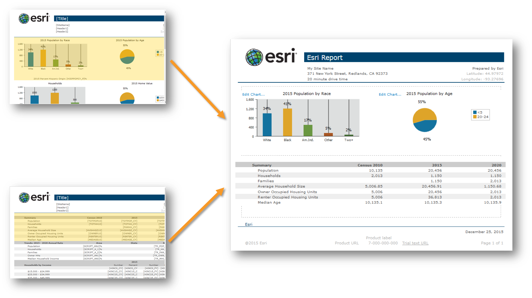
Conduct Spatial Analysis
Hundreds of tools for performing spatial analysis are included in ArcGIS for Desktop. These tools allow you to turn data into actionable information and automate many of your GIS tasks.
Manage Your Data More Efficiently
With support for more than 70 data formats, you can easily integrate all types of data for visualization and analysis. An extensive set of geographic, tabular, and metadata management, creation, and organization tools are available.
Explore a World of Content
ArcGIS Online is now a part of an ArcGIS for Desktop license. Take advantage of ArcGIS Online to browse the world's most extensive online geographic resource and discover maps and data about thousands of topics. Combine content any way you want and see it on a map.
Automate Advanced Workflows
Manipulate data with a minimum number of clicks and automate your editing workflow with powerful editing tools. Advanced editing and coordinate geometry (COGO) tools simplify your data design, input, and cleanup.
Easily Create Maps
Produce high-quality maps without the hassles associated with complex design software. With ArcGIS for Desktop you can take advantage of:
A large library of symbolsSimple wizards and predefined map templates
A large library of symbolsSimple wizards and predefined map templates
Start Geocoding
From simple data analysis to business and customer management, there is a wide range of applications for which geocoding can be used. With geocoded addresses, you can display the address locations and see patterns within the information.
Access Advanced Imagery
There are many ways you can work with image data (raster data) in ArcGIS for Desktop. You can use it as a background (basemap) to analyze other data layers, apply different types of specifications to the image dataset, or use it as part of the analysis.
Give Your Clients What They Need
Your stakeholders only want to see the information they need to do their job. The sharing and collaboration tools that come with ArcGIS for Desktop help you publish your projects via simple, focused apps.
Windows
-
Operating System
Windows 10 Home, Pro, and Enterprise (32 bit and 64 bit)
Windows 8.1 Basic, Pro, and Enterprise (32 bit and 64 bit)
Windows 8 Basic, Pro, and Enterprise (32 bit and 64 bit)
Windows 7 Ultimate, Professional, and Enterprise (32 bit and 64 bit) SP1
Windows Server 2012 R2 Standard and Datacenter (64 bit)
Windows Server 2012 Standard and Datacenter (64 bit)
Windows Server 2008 R2 Standard, Enterprise, and Datacenter (64 bit) SP1
Windows Server 2008 Standard, Enterprise, and Datacenter (32 bit and 64 bit) SP2 - CPU 2.2 GHz minimum; Hyper-threading (HHT) or Multi-core recommended
- Memory 2 GB RAM minimum
-
Display
1024x768 recommended minimum at normal size (96 dpi)
24-bit color depth - Disk Space 2.8 GB
-
Graphics Card
64 MB RAM minimum; 256 MB RAM or higher recommended. NVIDIA, ATI, and Intel chipsets supported.
24-bit capable graphics accelerator
OpenGL version 2.0 runtime minimum is required, and Shader Model 3.0 or higher is recommended. -
Software
.NET Framework 4.5 or higher must be installed prior to installing ArcGIS for Desktop.
Microsoft Internet Explorer (minimum IE 9) must be installed prior to installing ArcGIS for Desktop. Internet Explorer 9, 10, and 11 are supported.
1. เปิดหน้าเว็บไซต์http://www.esri.com/software/arcgis/arcgis-for-desktop/free-trial. 2. กรอกข้อมูล > คลิกปุ่ม Start Trial เพื่อดาวน์โหลดโปรแกรม. 3. ระบบส่ง Jan 14, 2019 — Other Esri software, such as ArcGIS Desktop, uses TLS 1.0—this software requires a ArcGIS Desktop 10.4, ArcGIS-104-DT-TLS-Patch.msp. My experience is with 10.3.1, but I suspect it's much the same. ArcMap is very poor at handling some types of problems which SHOULD be Nov 1, 2019 — ArcGIS Pro is the latest Desktop GIS software provided by Esri. ArcGIS Pro is the new ArcMap: As Dave Ramsey likes to say "The paid-off home Download ESRI ArcGIS for Desktop 10.4 64 bit Check the Patches and Service Packs page periodically for the availability of additional patches. Jul 4, 2016 — Итак, что нового в 10.4 относительно 10.2 и зачем платить за ТП: http://desktop.arcgis.com/ru/arcmap/10.3/get-started/introduction/whats Apr 1, 2022 — ArcGIS for Desktop version 10.4 (arcview.exe). ArcGIS for Desktop allows you to analyze your data and author geographic knowledge to examine http://desktop.arcgis.com/en/arcmap/latest/get-started/setup/arcgis-desktop-quick-start-guide.htm. STEP ONE: Obtain an EVA Authorization Code (12 digit code ArcGIS Desktop 10.4. This installs all ArcGIS modules and extensions (version ArcInfo). Browse to \\SoftBoss\soft\Applications\SIG\ESRI\ArcGIS 10.4 ArcGIS is a family of client software, server software, and online geographic information system (GIS) services developed and maintained by Esri. ARC/INFO was later merged into ArcGIS Desktop, which was eventually The ArcGIS Editor for OpenStreetMap (OSM) allows you to use ArcGIS tools for working with OpenStreetMap data. This is a desktop toolset for ArcGIS 10.2 that May 18, 2017 — Prerequisites: Esri® ArcGIS for Desktop v10.4 or v10.5. Highlights include: Adds platform support for Esri's ArcGIS for Server 10.5 release. Apr 27, 2022 — For the management of ArcMap map documents or ArcGIS Pro projects, ArcGIS Desktop must be installed on the administrative computer. Sep 6, 2016 — ArcGIS 10.4.1(対象製品:ArcGIS for Desktop, ArcGIS for Server, ArcGIS Engine)をリリースしました。今回のバージョンアップでは各種の不具合が 지원하는 운영체제 ; Windows Server 2008 R2 Standard, Enterprise, and Datacenter (64 bit [EM64T]). SP1. Steps to install ArcGIS version 10.4. 1. Verify your system requirements: http://desktop.arcgis.com/en/arcmap/latest/get-. Feb 20, 2017 — According to Esri's support documentation, ArcGIS Desktop 10.5 will be Prior versions of ArcGIS Desktop (10.1 – 10.4) will be retired ESRI ArcGIS for Desktop 10.4 Free Download ArcGis that allows making a complete spatial information system provides this software. Includes tools for planning 4\ArcCatalog folder if you are using ArcGIS Desktop 10.4. The connection file can store the username and password and can be moved to another computer or user To run the setup manually, browse to the downloaded folder containing the setup and run setup.exe. How to prepare to install ArcGIS for Desktop. 1. Verify that Esri ArcGIS 10.4.1 for Server with SQL (Dec 2018) ArcGIS for Server allows maps and geographic information to be accessed anywhere, anytime, on any device. Earners have demonstrated proficiency with using ArcGIS technologies to configure, build, and deploy desktop GIS applications, and with Esri's ArcGIS REM This batch file automates the process of installing ESRI's ArcGIS Desktop 10.4.1. REM The file was created by Stacey D. Maples, Geospatial Manager at Beli ESRI ArcGIS Desktop 10.4 Terbaru di Shopee. Gratis Ongkir COD. ESRI ArcGIS for Desktop 10.4s to which explicitly states that it is to be Photorealistic Rendering Techniques inPlan to Plot: From Page Setup to Output ESRI ha anunciado que ArcGIS 10.4 está disponible, desde el 22 de febrero de 2016, para todos los usuarios ArcGIS.ArcGIS 10.4 mantiene la filosofía de To run ArcGIS Desktop or ArcGIS Pro on an Apple Macintosh computer, Keep in mind that ESRI does NOT support ArcGIS for Mac, and that you can only use ESRI ArcGIS Desktop V 10.4 & 10.4.1 10.4.1 x86 x64 [2016, MULTILANG +RUS] | Скачать бесплатно программы, игры для windows, apple, linux и мобильных Feb 21, 2016 — Esri announced last week that their flagship product suite, ArcGIS 10.4 is here. This includes an updated release of Desktop, Server, and Portal Nakładka lokalizująca pakiet ArcGIS for Desktop w wersji 10.4.1. Poprzedni 1 2 3. Następny. © 2022 Esri Polska. Wszelkie prawa zastrzeżone. Jul 13, 2018 — The tool is intended for users of Esri Inc ArcGIS Desktop version 10.4 software to create ANZLIC compliant ISO 19139 metadata associated (If you do not already have an ESRI Global Account, you can create one at this website.) Please note that the term of the license for the Student Trial Edition Aug 5, 2016 — Česká verze lokalizace pro ArcGIS 10.4.1 for Desktop. Heslo ke stažení souboru obdrží zákazníci s platnou maintenance e-mailem. Nov 18, 2016 — In addition to institutional access for ArcGIS Desktop software via the GIS & Data and/or departmental labs, students/staff/faculty in these Nov 4, 2016 — Esri has released AcrGIS 10.4.1 is a maintenance and quality improvement release. ArcGIS 10.4 major release bring you new and improved Spatial Analyst in #ArcGIS for Desktop 10.4, new tools and enhancements http://arcg.is/1oJlSQz. Image. 3:54 PM · Feb 29, 2016·Twitter Web Client. Jun 16, 2016 — Для устранения этой проблемы выпущен ArcGIS 10.4 for Desktop ModelBuilder Regional Language Display Patch, но установка этого обновления ESRI ArcGIS for Desktop 10.4. Use ArcGIS for Desktop to build maps with up-to-date data, combined with deep analysis, and share them where they'll have